


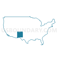
Valencia, Bernalillo (East Mountains) Counties & Isleta Pueblo PUMA, New Mexico
About
Outline
+Counties+%26+Isleta+Pueblo+PUMA%2c+New+Mexico_A280.png)
Summary
| Unique Area Identifier | 193455 |
| Name | Valencia, Bernalillo (East Mountains) Counties & Isleta Pueblo PUMA |
| State | New Mexico |
| Area (square miles) | 1,541.81 |
| Land Area (square miles) | 1,538.90 |
| Water Area (square miles) | 2.91 |
| % of Land Area | 99.81 |
| % of Water Area | 0.19 |
| Latitude of the Internal Point | 34.80318970 |
| Longtitude of the Internal Point | -106.70747810 |
Maps
+Counties+%26+Isleta+Pueblo+PUMA in New Mexico.png)
Graphs
Select a template below for downloading or customizing gragh for Valencia, Bernalillo (East Mountains) Counties & Isleta Pueblo PUMA, New Mexico
+Counties+%26+Isleta+Pueblo+PUMA%2c+New+Mexico_T0.png)
+Counties+%26+Isleta+Pueblo+PUMA%2c+New+Mexico_T1.png)
+Counties+%26+Isleta+Pueblo+PUMA%2c+New+Mexico_T2.png)
+Counties+%26+Isleta+Pueblo+PUMA%2c+New+Mexico_T3.png)
+Counties+%26+Isleta+Pueblo+PUMA%2c+New+Mexico_T4.png)
+Counties+%26+Isleta+Pueblo+PUMA%2c+New+Mexico_T5.png)
+Counties+%26+Isleta+Pueblo+PUMA%2c+New+Mexico_T6.png)
+Counties+%26+Isleta+Pueblo+PUMA%2c+New+Mexico_T7.png)
+Counties+%26+Isleta+Pueblo+PUMA%2c+New+Mexico.png)
Neighbors
Neighoring Public Use Microdata Area (by Name) Neighboring Public Use Microdata Area on the Map
- Albuquerque City (Central) & Bernalillo County (North Valley) PUMA, NM
- Albuquerque City (Far Northeast Heights) PUMA, NM
- Albuquerque City (Near Northeast Heights) PUMA, NM
- Albuquerque City (Northwest Mesa), Paradise Hills & Navajo Nation-Tohajiilee Chapter PUMA, NM
- Albuquerque City (Southeast Heights) PUMA, NM
- Albuquerque City (Southwest Mesa) & Bernalillo County (Southwest Mesa & South Valley) PUMA, NM
- Northwest New Mexico--Navajo Nation PUMA, NM
- Sandoval County PUMA, NM
- Santa Fe County PUMA, NM
- Southwest New Mexico PUMA, NM
Top 10 Neighboring County (by Population) Neighboring County on the Map
- Bernalillo County, NM (662,564)
- Santa Fe County, NM (144,170)
- Sandoval County, NM (131,561)
- Valencia County, NM (76,569)
- Cibola County, NM (27,213)
- Socorro County, NM (17,866)
- Torrance County, NM (16,383)
Top 10 Neighboring County Subdivision (by Population) Neighboring County Subdivision on the Map
- Albuquerque CCD, Bernalillo County, NM (633,223)
- Rio Rancho CCD, Sandoval County, NM (113,761)
- Los Lunas CCD, Valencia County, NM (55,761)
- Santa Fe South CCD, Santa Fe County, NM (39,958)
- Belen CCD, Valencia County, NM (20,808)
- East Bernalillo CCD, Bernalillo County, NM (19,056)
- Socorro CCD, Socorro County, NM (14,354)
- Estancia CCD, Torrance County, NM (14,089)
- West Bernalillo CCD, Bernalillo County, NM (7,796)
- Laguna CCD, Cibola County, NM (4,459)
Top 10 Neighboring Place (by Population) Neighboring Place on the Map
- Albuquerque city, NM (545,852)
- South Valley CDP, NM (40,976)
- Los Lunas village, NM (14,835)
- North Valley CDP, NM (11,333)
- Corrales village, NM (8,329)
- Belen city, NM (7,269)
- Los Chaves CDP, NM (5,446)
- Rio Communities CDP, NM (4,723)
- Meadow Lake CDP, NM (4,708)
- El Cerro Mission CDP, NM (4,657)
Top 10 Neighboring Unified School District (by Population) Neighboring Unified School District on the Map
- Albuquerque Public Schools, NM (667,445)
- Los Lunas Public Schools, NM (48,173)
- Belen Consolidated Schools, NM (30,853)
- Grants-Cibola County Schools, NM (27,088)
- Bernalillo Public Schools, NM (24,342)
- Moriarty Municipal Schools, NM (23,044)
- Estancia Municipal Schools, NM (4,797)
- Mountainair Public Schools, NM (1,866)
Top 10 Neighboring State Legislative District Lower Chamber (by Population) Neighboring State Legislative District Lower Chamber on the Map
- State House District 12, NM (38,723)
- State House District 50, NM (31,808)
- State House District 20, NM (31,358)
- State House District 15, NM (31,051)
- State House District 49, NM (31,024)
- State House District 23, NM (30,981)
- State House District 22, NM (29,758)
- State House District 31, NM (29,664)
- State House District 7, NM (29,350)
- State House District 8, NM (28,864)
Top 10 Neighboring State Legislative District Upper Chamber (by Population) Neighboring State Legislative District Upper Chamber on the Map
- State Senate District 11, NM (77,027)
- State Senate District 22, NM (60,988)
- State Senate District 10, NM (57,103)
- State Senate District 9, NM (52,758)
- State Senate District 29, NM (50,755)
- State Senate District 30, NM (48,188)
- State Senate District 21, NM (48,064)
- State Senate District 19, NM (45,690)
- State Senate District 14, NM (42,652)
- State Senate District 16, NM (42,389)
Top 10 Neighboring 111th Congressional District (by Population) Neighboring 111th Congressional District on the Map
- Congressional District 1, NM (701,939)
- Congressional District 3, NM (693,284)
- Congressional District 2, NM (663,956)
Top 10 Neighboring Census Tract (by Population) Neighboring Census Tract on the Map
- Census Tract 9406, Bernalillo County, NM (9,385)
- Census Tract 9703.01, Valencia County, NM (7,334)
- Census Tract 37.32, Bernalillo County, NM (7,228)
- Census Tract 9636, Torrance County, NM (6,854)
- Census Tract 9707, Valencia County, NM (6,841)
- Census Tract 111, Sandoval County, NM (6,812)
- Census Tract 9701.02, Valencia County, NM (6,630)
- Census Tract 9703.03, Valencia County, NM (6,557)
- Census Tract 37.22, Bernalillo County, NM (6,335)
- Census Tract 37.21, Bernalillo County, NM (6,272)
Top 10 Neighboring 5-Digit ZIP Code Tabulation Area (by Population) Neighboring 5-Digit ZIP Code Tabulation Area on the Map
- 87121, NM (76,721)
- 87114, NM (61,623)
- 87105, NM (57,680)
- 87111, NM (56,490)
- 87031, NM (44,075)
- 87112, NM (43,584)
- 87123, NM (41,468)
- 87002, NM (22,517)
- 87122, NM (17,977)
- 87113, NM (14,477)